
A Water Glossary of Marseille
©Pierre-Yves Brunaud
By Hannah S. Palmer
Atlanta-based writer and artist Hannah S. Palmer came to Marseilles in April 2023 as part of Villa Albertine’s City/Cité program and Terres Communes, an event co-produced by the Guide Bureau of GR2013 and the Cité de l’Agriculture, with Friche la belle de Mai. A leading Atlanta voice in ecology and environmental justice, she has developed numerous projects on the issue of water and urban rivers. It was also on the subject of water that she wrote on her return from Marseille.
Sunday, April 23: The drought
The first vocabulary word I learned in the parking lot of Marseille-Provence Airport was sécheresse. Lucie Duriez, Cultural Director of La Friche la Belle de Mai, picked me up on her day off. She apologized for the dust on her car.
Since March, she explained, Marseille had been in a declared state of drought, meaning restrictions on water use for activities such as swimming, irrigation, and washing vehicles. There had been very little rainfall all winter, whole months with no precipitation. And now it was spring—typically windy and dry, and still no rain.
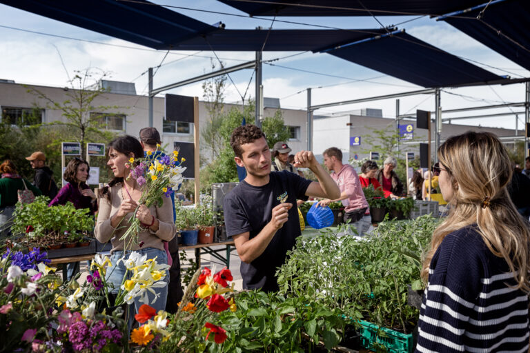
I was there to participate in Terres Communes, a conference on urban agriculture and ecology at La Friche. Our small but mighty “Atlanta Delegation” was invited by Villa Albertine’s CITY CITÉ initiative which brought together creatives and activists from Atlanta and Marseille to explore “the role of cultural infrastructure in the making of cities.”
In Duriez’s concern about the drought, I heard the same climate anxiety that presents as the dread of flooding and storms in Atlanta.
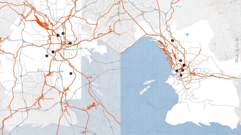
In addition to the conference, we were given an ambitious itinerary of visits to urban farms, art centers and creative studios, and radical hikes around the city. Most importantly, I was there to experience Les Aygalades, Marseille’s urban river at the heart of an ongoing ecological restoration project like my work with Finding the Flint. I traveled to Marseille to look for water.
From the airplane, Atlanta and Marseille couldn’t look more different. As we lifted off from my neighborhood near Hartsfield-Jackson Atlanta International Airport, Atlanta sprawled as far as the eye could see. There’s no obvious logic to its form, just endless tangles of highways and suburban ganglia radiating out from a skyscraper spine. Marseille, on the other hand, was concentrated around its seaports, a low and dense circuit board of terracotta rooftops hugged by mountains on one side and the unreal blue of the Mediterranean on the other. Flying in, I hardly recognized a shining belt of water as a river. The Rhône looked utterly artificial, strictly contained, no relation to the brown, meandering, wild-edged rivers of Georgia.
Despite the lack of rainfall, the highway from the airport was lined with banks of bright wildflowers.
The second new word I learned in Lucie’s car was calcaire. From the chalky cliffs to the limestone block building blurring by my window, the pale stone was omnipresent. I would learn that calcaire was what made the Mediterranean waters glow turquoise. The arid limestone prairie made the sunbleached wildflowers bright and the classic herbes de provence fragrant. The unforgiving terrain had this concentrating effect on the people too.
Beyond my sight-seeing impressions of the city—the beaches, the touristy Vieux Port, the view from the Palais du Pharo, beyond even the charming Longchamps district where my AirBnb no doubt annoyed the neighbors, I would encounter a city that very much resembled my hometown. I recognized the people on the streets—young, diverse, disenfranchised, and driven. Marseille was a product of its seaport, Atlanta, its airport, both shaped by waves of immigration and struggle and bizarre and monumental deposits of wealth from foreign investors. Both cities felt dominated by a vast working class of non-White families, hustling to break through in not just business, but art, music, remaking the city. Not only to survive but to achieve immortality.
Somehow, the red poppies and yellow spanish broom were surviving parched roadside conditions. There had to be water somewhere.
Monday, April 24: The Durance
My son asked me to record the birds of Marseille. Each morning, I stood at my third-floor window overlooking a string of bristly green courtyards, the silhouette of Notre Dame de la Garde visible in the distance. I heard gulls, a parakeet, an insistent dove. This was a very short and somewhat disappointing list to relate to him. On an average spring morning in Atlanta, he recorded dozens of different species of songbirds in the water oaks and pecan trees on our block. Was this difference due to Marseille’s density, Atlanta’s tree canopy, or both? Or could it be a symptom of drought?
On my walk to La Friche, I stopped to photograph the Palais Longchamp, a grandiose 19th-century building and gardens flanking an elaborate central fountain. A bronze historical marker said it was built to celebrate the completion of the Canal de Marseille, a marvel of engineering that delivered a steady flow of clean water across a mountain range to the growing city. Today, the fountains were silent.
I enjoyed the too-muchness of the place. The Corinthian columns and staircases and stone arches, a parade of stone lions, bulls, and gryphons all led the eye to a towering goddess representing the Durance River, her foot on an overturned urn. Early on a Monday morning, workers and students hustled past this spectacle. It was just me and a couple sanitation workers gathering litter in the park. Not only was this kind of extravagant architectural landmark absent in my young city, this reverence for water was missing, too. Did the arrival of the canal in 1849 affect the perception of Marseille’s natural waterways? Did its opening make Les Aygalades obsolete? Or had the city already polluted and exhausted the natural creeks and rivers, creating the need for a canal?
Longchamp bore the signs of drought— the formal lawns were patchy and windblown. Overlooking the lower basin of the grand fountain, I read a small red warning zip-tied to the iron fence: baignade strictement interdite. No swimming at the temple of water.
The dry fountain was striking. At Longchamp, water was depicted as divine power and wealth. The entire construction represented the city as distributing that power. But a dry fountain broadcast the limits of government, maybe even the folly of man’s control over nature.
The canal was built in anticipation of seasonal drought, and for a 19th century climate. The old infrastructures were proving insufficient in the face of sustained climate change, the loss of snowpack upstream, vanishing glaciers. Here was a city confronting its limits.
I noticed this because I come from a place that makes one crave limits. Atlanta sprawls without any natural boundaries, no mountain range or waterfront to contain haphazard development. Indeed, Atlanta was engineered in defiance of its terrain. The gentle piedmont ridges and creeks were easily subdued in an era of mega infrastructures, first railroads and dams, then superhighways and airports.
Beginning with the Flint River headwaters under the airport, I had immersed myself in a years-long search for Atlanta hidden and degraded waters. I learned to see how the city is shaped by springs and wetlands, creeks and floodplains.
That night, walking back to my apartment, I heard a chorus of frogs long before I could see the Palais Longchamp. The little pagans found the water.
Tuesday, April 25: The slag heap
© Pierre-Yves Brunaud
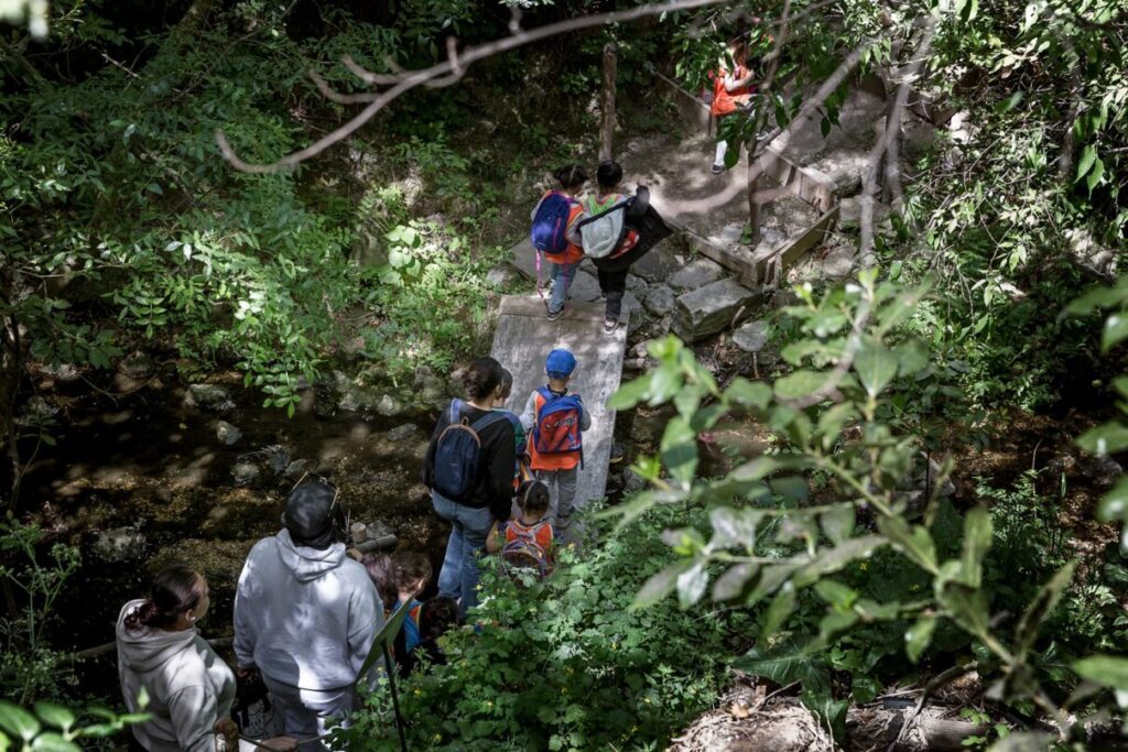
We met the photographer Geoffroy Matthieu at La Friche for a driving tour of the Les Aygalades. He presented a copy of his gorgeous book La mauvaise réputation. Painted across the parking lot in Magritte’s script: ceci n’est pas un parking.
As we loaded into his Volkswagen, I spotted the river maps and bright yellow safety vests stored in his trunk and laughed. The same items cluttered the trunk of my car.
On the way to the river, Geoffroy tried to explain the EuroMed redevelopment program that was transforming Marseille’s post-industrial waterfront into an architect’s dream of the future city. They pointed out all the skyscraper apartments under construction, the proposed parks, and waiting storefronts, sleek modernism that looked bland in contrast with the scruffy limestone and terra cotta buildings of old Marseille. Young street sycamores flapped their leaves like flags. The invasive presence of construction cranes remaking the skyline reminded me of Midtown Atlanta, where mixed-use developments topped with luxury condos climbed skyward while nearby neighborhoods languished from a lack of investment. Who was this for?
Our first stop was the waterfront headquarters of the global shipping company CMA CGM. I remembered these letters from container ships passing through the Savannah River; today I learned the “M” was for Marseille. Locally derided as “the zipper,” CMA CGM’s glassy tower sloped up from a wide base at the edge of the port with vertical lines cinched in the center. Nothing else on the Marseille skyline looked anything like it.
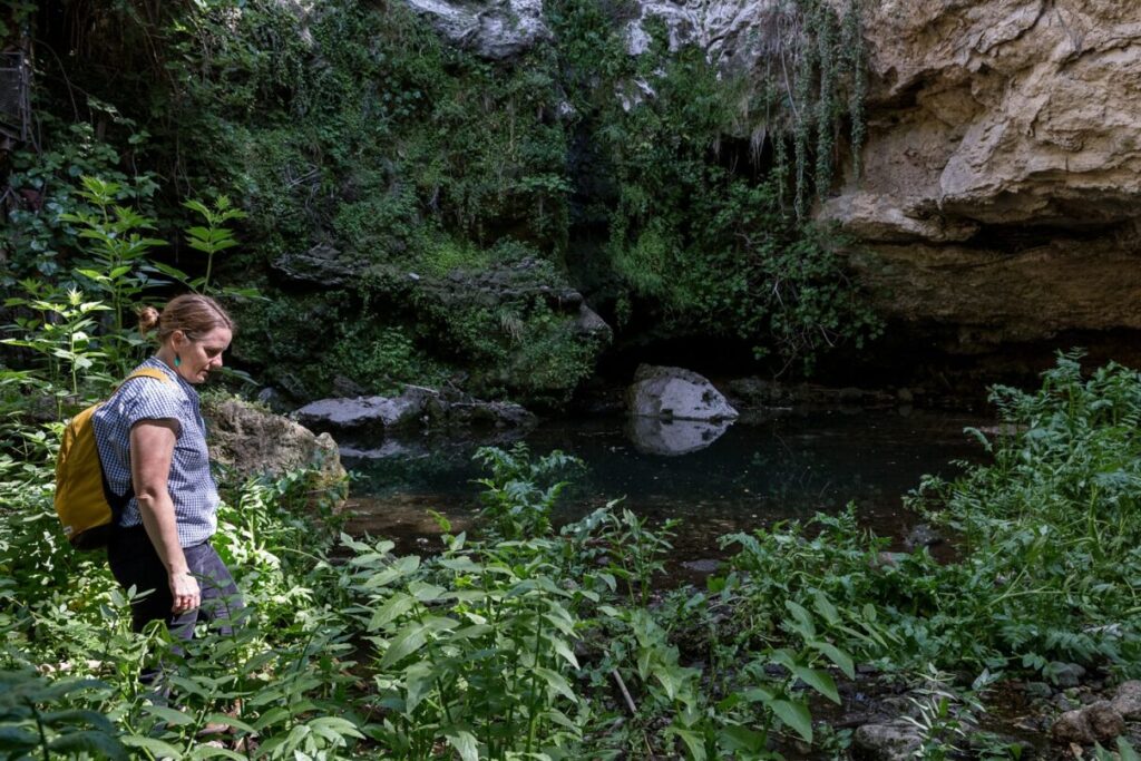
Geoffroy found a place to park near the tower’s base. He pointed out a strange rectangular trench between a row of parked cars and a junkyard—Le Ruisseau des Aygalades. We leaned over an iron barricade to watch our reflection warble in water eight feet below. To the west, two more long, barricaded stream segments revealed the course of the river. Ceci n’est pas un rivière, I thought. It was not even a moat. It was like an open casket.
He explained this part of the river was recently re-engineered and daylighted to contain flooding. I couldn’t see a fish or a leaf in the black water. When he pulled out a laminated map of Les Aygalades, I wanted to hug him. How many times had I led people to the headwaters of the Flint and brandished a watershed map to convince them that the pitiful ditch we saw was indeed part of a larger river.
© Pierre-Yves Brunaud
© Pierre-Yves Brunaud
We continued upstream to see other versions of the alien stream, each stop slightly less devastating than that first glimpse. As we moved away from the freshly reimagined port, Les Aygalades began to resemble a more natural stream—channelized but meandering, rippling over stones and ruins, shaded and green. The graffiti was more intricate, the urban decay more charming, figs and daisies and ivy broke through old concrete, reaching out for water. Even Geoffroy, after years of documenting these hidden waters, was surprised to spot a young couple sunbathing along the canal.
He encouraged us to jump a fence to get a better look at the river from atop a hill. I asked if he ever got in trouble for trespassing and he said no. “I look like an old dad.”
Of course, none of this was “natural,” but the product of two hundred years of industrial development. We waded through the waist-high grass to get a look at the creek from above and I tried not to think about what made up the terril, or dump. It was a slag heap from the nearby foundries and factories, the ground beneath our feet was red with rust and crumbly as old cake.
There was a capped landfill between Sullivan Creek and the Flint River. It looked like a grassy hill, the city even named it “Green Acres,” but I knew it was an unlined landfill and had for years accepted the inks used in printing the Atlanta Journal-Constitution, among other unsavory items that no other construction landfill would accept. I assumed all that was leaching into the river today. I didn’t want to think about it.
The view of the city was breathtaking— factory rooftops, smokestacks, then housing projects, and shadowy mountains in the distance. The wind passed through us in the waist-tall grass, kept moving the puffy clouds into a great whorl overhead. I tugged sun-bleached snail shells from the tall grass, as big and light as ping pong balls. How did they grow so large?
Friday, April 28: The riparian forest
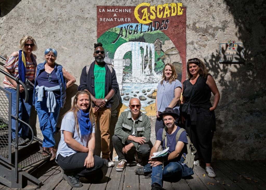
When the city of Marseille bought the old L’Abeille oil and soap factory in northern Marseille in 1999 to create a massive cultural compound called La Cité des Arts de la Rue, did they know the property included the ruins of a waterfall? The Cascade des Aygalades were demolished during the construction of the A7 highway in World War II, but the Ruisseau des Aygalades was still hidden back there. The stream snaked through a ravine behind the factory, forming the western edge of the property.
Now a factory for public art, La Cité became a collection of industrial buildings repurposed as large-scale studios, galleries, classrooms, and workshops. Did the architects imagine that resident artists would someday discover the river behind the buildings and direct their creative energy outside ? Since 2013, activists, sculptors, dancers, poets, and musicians have transformed this marginal greenspace into a vital cultural playground for the community. They named it the Jardin de la Cascade.
We had time to explore the grounds of La Cité before our scheduled meeting with Le collectif des Gammares, the activist-artists behind this transformation. Twenty-five years of accumulated creative detritus made the place look like a combination film studio backlot and folk-art shrine. Amid the oversized props and vintage vehicles I saw a human-sized bird cage, dismembered mannequins, and a carousel horse mounted on a Peugeot. A massive cube of savon Marsellaise was parked in the hangar, a monument to the craft that occupied the site for a century. Again, I marveled at the dry climate. In Atlanta’s humidity, a giant hunk of soap wouldn’t last long. In fact, all of this would be consumed by kudzu and mushrooms in a month.
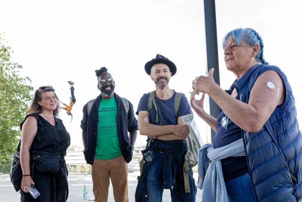
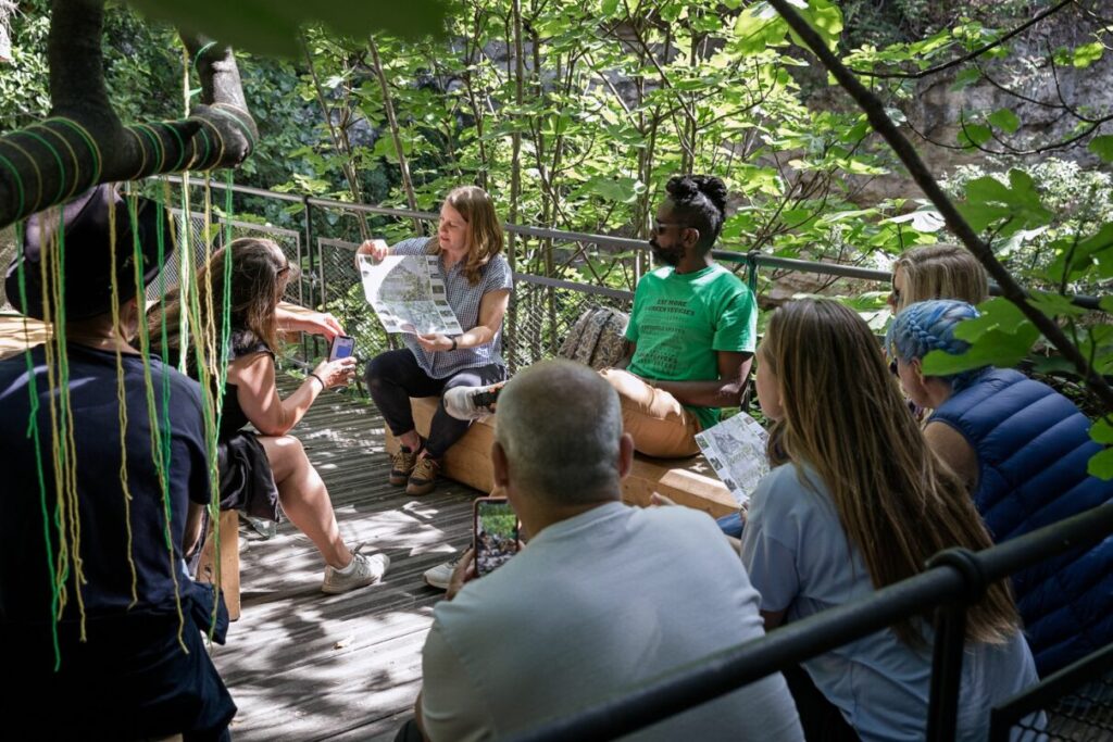
We gathered on La Cite’s grant terrace overlooking the city to meet Les Gammares—Charlie Fox, Marine Torres, and Agnes Jouanaud whose signature look was head-to-toe blue with sky-blue braids. Charlie wore a button with a smiling cartoon shrimp, their friendly mascot for the river. Here was another new word for me: gammare, a tiny freshwater crustacean that lived in Les Aygalades. All creeks should have a mascot! I cheered. Or a goddess like La Durance at the Palais Longchamp.
© Pierre-Yves Brunaud
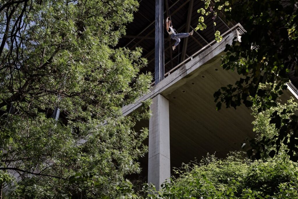
As aerialist dancers dangled overhead, rehearsing for a performance, Les Gammares recounted a familiar story of urban stream syndrome: industrial discharge, polluted runoff from highways, channelization of the natural creek like an open sewer, a couple centuries of contamination in the soil and groundwater. A quarry degraded the source of the river, not unlike the granite quarries I have toured along the Flint River headwaters. Les Aygalades absorbed aluminum leaching from a pharmaceutical factory upstream, the Flint contended with jet fuel from the airport. Different contaminants, same result: a complete erasure of the nuisance river.
© Pierre-Yves Brunaud
Agnès, cigarette in hand, declared that she was baptized in Les Aygalades. This was hard to picture, based on the shallow creek we saw on Tuesday, but I trusted her testimony. Agnes talked about her attachment to the land, a sense of indwelling as “a GPS in the head, and a bioregion in the body.” At one point during our hike, she plucked a handful of elderflower and stuffed it in her mouth without breaking her stride.
Marine wrote ripisylve for me in my notebook—riparian forest. A duet of dancers bounded across the façade of the building.
Les Gammares had successfully reoriented the factory to its backdoor. We filed down the stairs leading under the building, drawn towards the water. As the city disappeared, I felt at home. Under the building, the air was cool and humid and smelled like a cellar.
© Pierre-Yves Brunaud
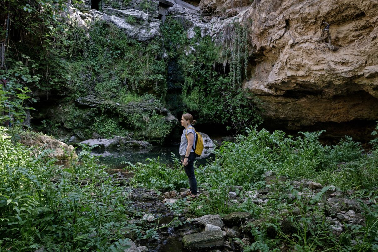
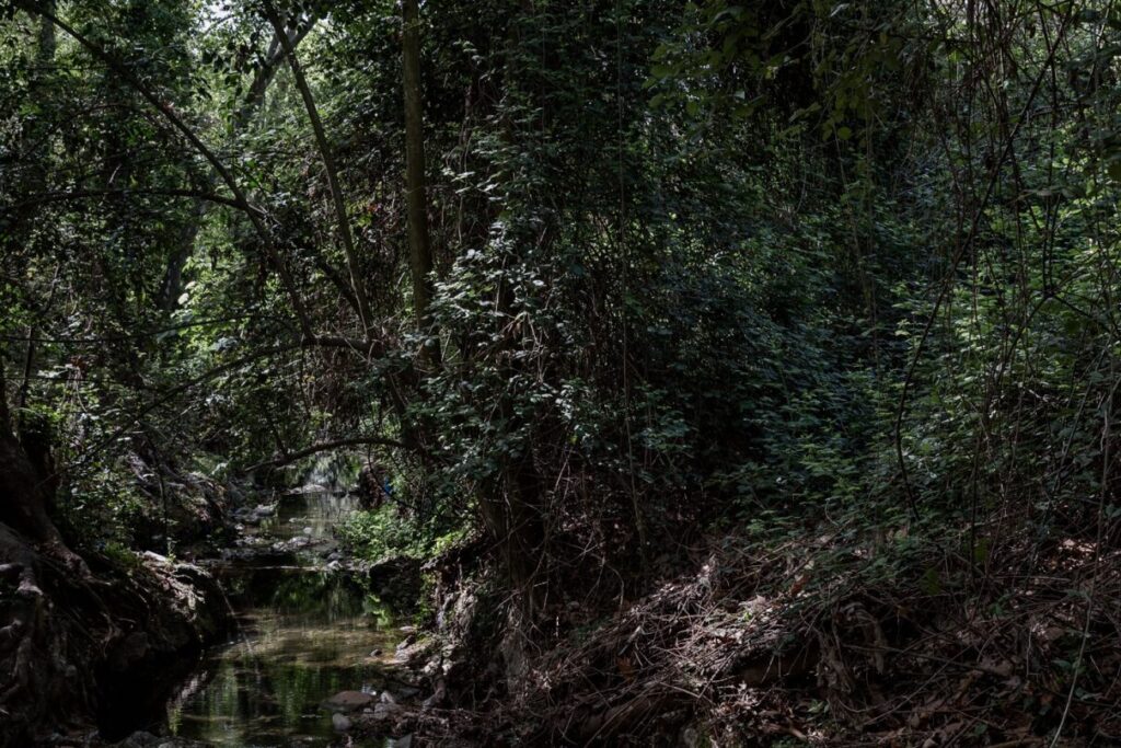
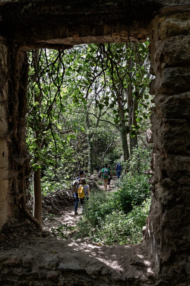
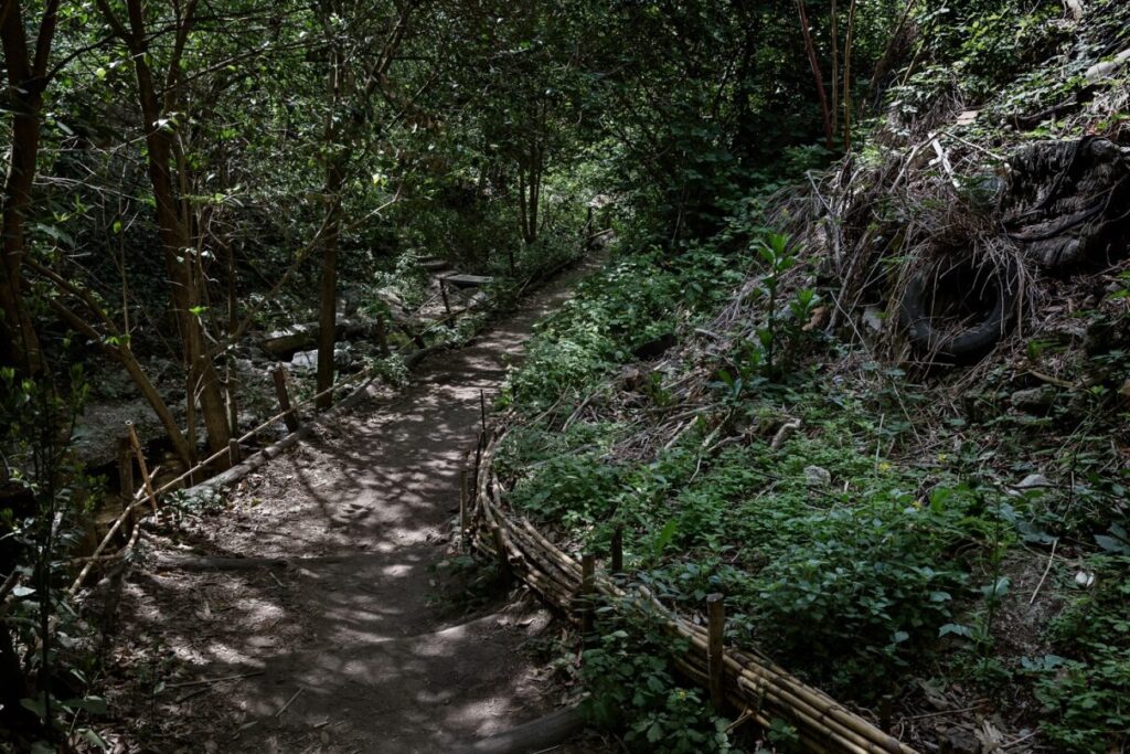
We hiked the short trail to the waterfall. It followed the quiet creek like a tunnel through the vines. The water was maybe six feet wide, shallow but clear. It rippled over small stones and chunks of construction debris and curious, embedded urban trash. Along the way, the trail was marked with episodes for reflection on the history, ecology, and future of Les Aygalades, from a giant water wheel sculpture to QR codes linking to original music and poetry. Right away, I departed from the trail and stepped down into the creek bed to look for frogs, snails, critter tracks—any signs of non-human life. It was a comfort to hold my face down in the mossy heart of this strange landscape. Purple petals scattered the banks like confetti.
© Pierre-Yves Brunaud
The trail and the creek looked and smelled like my old friend, the Flint, right down to the ruins of an old mill. The cascade was now an art project, a fountain recycling water from the blue hole back to the top of in impressive limestone outcropping. Faintly audible overhead was the sound of the A7.
We stopped on a creekside deck to talk about the links between our lost urban waters and their potential for restoration. As usual, I started my story acknowledging that in 1821, the Flint River marked the international treaty boundary of the state of Georgia and the Muscogee Creek nation. Before that, while windmills and rural castles like la bastide de la Guillermy overlooked Les Aygalades, Indigenous communities were farming, fishing, trading, and traveling along the Flint River, calling it Hlonotiskahachi. As the translator muttered in French to Agnes, I wondered how she would manage this part of the story.
In all my years of giving presentations about Finding the Flint in boardrooms, classrooms, nature centers, in tents, under bridges, in canoes, and on Zoom, this venue was a revelation. This is what we need on the Flint River! For years we have been working to acquire land for a public park. Without it, the whole restoration project was so abstract, so limited. We needed control of one small patch of land along the headwaters, a place that we could clean up and restore and carve out a few trails and clearings. Where we could invite the public to explore and birdwatch, to gather water samples and catch tadpoles. This place was an outdoor classroom, gallery, and patio. They created a joyful, relaxing pocket of forest to tell a new story for this lost cause river. I had no safe place to even host a clean-up event on the Flint River, forget hosting a picnic.
© Pierre-Yves Brunaud
I left the site feeling restored and inspired, but also jealous. I envied the Jardin de la Cascade, their unique public interface with the river. I also envied the incredible materials that the collective produced. Marine and Charlie gave me a set of the Gazette du Ruisseau, an eclectic quarterly newspaper filled with drawings, musings, comics inspired by the river and their adventures engaging the community. They gave me a neon-colored child’s guide to the river, Le Cahier du Ruisseau, filled with maps, coloring pages, jokes, and stickers.
I hoped to steal all these ideas, eventually. But I realized how much work goes into hand-drawn maps, original illustrations, graphic design, production, and printing of such collateral. Time, creativity, and love. Devoted and repeated observation and inspiration akin to worship. It takes a river of money to create a park, to maintain it over years, to make it safe and welcoming, to fill it with art and programming and life.
“You should form a collective!” Marine suggested.
Obviously, I needed a bigger team. I need seven more full-time collaborators, plus a dozen contributing artists, guides, ecologists, designers. But who would pay for that?
I deduced that French collectives were like the countless nonprofits organized to support Atlanta’s cultural, historical, environmental projects and social needs. Most of my friends and colleagues worked for such organizations or were supported by them. We all spent a lot of time working on, distracted by, and competing for philanthropic grants and corporate funders. It was hard to understand the level at which the city, county, state, and national governments of France financially sustained the work of creative artists and storytellers here.
I couldn’t stop thinking about money. How was all this funded ? The building and the hundreds of cultural workers inside it. How were they surviving ? Paying for the basics like housing, groceries, and transportation. Certainly, they were free of the crushing cost of American healthcare, childcare, and education.
Also, I noticed that everyone we met appeared to be White. Even though I assumed the racial category that applies to me in the U.S. doesn’t exactly match up with social identities in France, it seemed that such a grand public facility should resemble the community it served. Where were the dark-skinned, arabic-speaking artists, administrators, academics, and performers from the immigrant and working-class neighborhoods of Marseille? This was a constant conversation in the U.S.—how to expand diversity in the conservation movement, to welcome all people in outdoor spaces, beyond the environmental justice movement.
Sunday, April 30: The coastline
It finally rained on my last morning in Marseille. Merely a gray dribble on tile rooftops, just enough to rinse the dust from the sycamore leaves. I imagined all the farmers I met that week rejoicing.
The rain did not impede our plans to visit the Chateau d’If and the Frioul Islands. We boarded the ferry in a heavy mist, and I prepared myself with a couple anti-nausea tablets.
After touring the castle prison, our group bunched under umbrellas at the tiny outdoor café for a lunch of salty panisse and whole sea bass. Another ferry ride, this one sunny and warm, less rocky. The clouds retreated as we ferried over to the Frioul Islands.
We peeled off our raincoats and scarves as we walked the gravel trail to the Plage de Saint-Estève. I understood the signs along the coastal path that warned about “chutes de pierres,” but asked Lucie to define the word littoral. It described the protected seashore habitat all around us.
Again, here was the reverence for water. Not just the educational signage about the littoral ecosystem, but the larger Parc National des Calanques created in 2012. This was “Special Area of Conservation and Special Protection Area,” officially sanctioned by the national government. What would it look like if Marseille’s other waterways were protected at this level? First, the littoral. Next, the ripisylve.
The beach was tucked between cliffs, a calm blue cove shielded from the wind, filled with families and sun-worshippers. Lucie was the first to swim out. Her black hair bobbed in the blue water. She believed, like many people here, that an icy plunge in the sea was healthy and life-giving.
Seeing happy toddlers in the water encouraged me. It felt like the entire trip led up to this moment, the entire nation cradled this perfect little beach as it had for thousands of years. Finally, we waded into the sea, squealing and gasping. The rain was a distant memory. I managed to slip underwater.
©Pierre-Yves Brunaud
July 2023
Hannah S. Palmer is a writer and artist interested in Southern identity in the urban landscape. A native of Atlanta’s Southside, she wrote about the neighborhoods erased by Atlanta’s growing airport in her memoir Flight Path: A Search For Roots Beneath The World’s Busiest Airport. Exploring the privatized, segregated, and sullied waters of the urban South with her family has led to a new book project called The Pool is Closed and her latest brainchild, Atlanta Creek League, a project that helps people find, enjoy, and take care of the creeks in their neighborhood.
For more than a week in Marseille, Terres Communes organized conferences, workshops and public walks, in relation with Sebastien Marot’s exhibition Taking the Country’s Side (Agriculture & Architecture).
Related content
Sign up to receive exclusive news and updates Subscribe